crAIzeSmartCity Log in

Your city in one model

crAIze SmartCity brings every building, every street, traffic and roadworks into one model that runs scenarios and answers questions. For cities and companies that want to plan with an intelligent city: administration, council and citizens as well as companies with their own projects.

crAIze SmartCity is in beta. If you already have access, log in via “Log in” at the top.

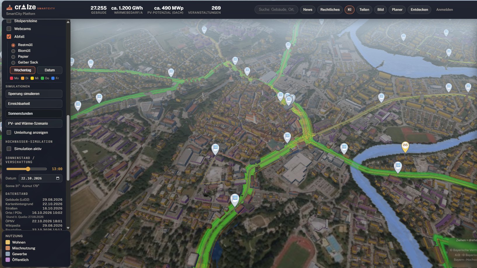
crAIze SmartCity: the 3D city model on the aerial image with the river, public transport lines and live traffic, layers, simulations and data status on the left, key figures of the city at the top.

What crAIze SmartCity does

A 3D model shows what a city looks like. crAIze SmartCity also knows what is happening in it and works out what would happen: if a road is closed, the water level rises or a new building goes up.

From the demo environment

27,255
buildings
489 MWp
rooftop solar potential
1,224 GWh
heat demand per year
6
simulations
  • Knows every building Use, height, heat demand and solar potential for every single building, in one click.
  • Lives with the city Live traffic, roadworks and closures, public transport, events, waste collection dates, webcams. The data keeps coming in.
  • Knows the sports venues Stadiums and halls with their fixtures in the city model.
  • Works out what would happen Close a road and see the detour. Raise the water level and see what floods. Plus travel-time reach, hours of sunshine and scenarios for solar and heat.
  • Plans with you In the 3D planner, import designs as 3D models or draw the building volume yourself. The platform shows which neighbours the new building overshadows.
  • Guides visitors through the city Visitors state their interests and their time. The platform suggests the route.
  • Hosts your own portal Companies plan and market their projects with their own data and viewer. The data stays under their control.
  • Answers questions The AI assistant knows the city's data. Ask in plain language and get an answer with numbers.
  • Shows where every figure comes from Every layer states its origin and date, whether official geodata, open sources or our own calculation.

Insights

Figures and images come from a demo environment built on publicly available data. There is currently no official cooperation with the municipality shown.

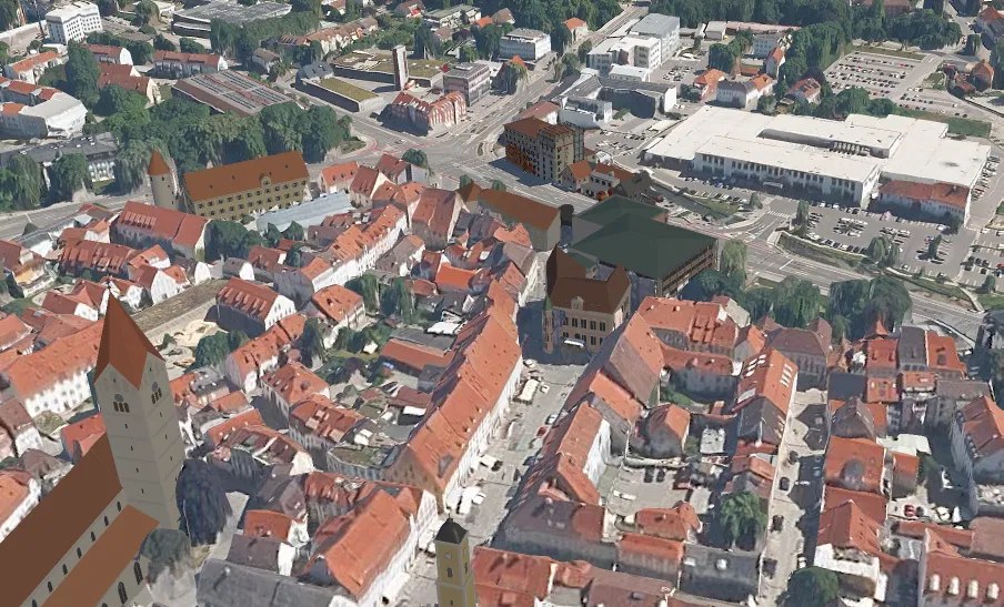
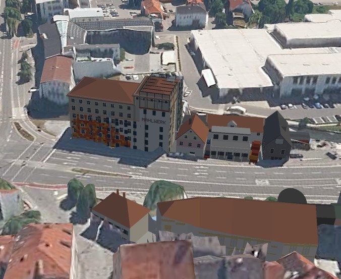
The 3D planner: an imported design among existing buildings in the photorealistic city model, seen from above. The imported design up close: a hotel with a glass rooftop among its neighbours.
An imported design in the city model, from above and up close.
3D planner

Put the new building into the city before it is built

Import the architect's design as a 3D model or draw the building volume right in the platform: corner by corner, set the height, rotate it, move it into place. The new building stands among its real neighbours, from every angle.

Then the planner works out the consequences: which buildings would be in shadow, how many hours of sunshine they lose and how much solar yield that costs.
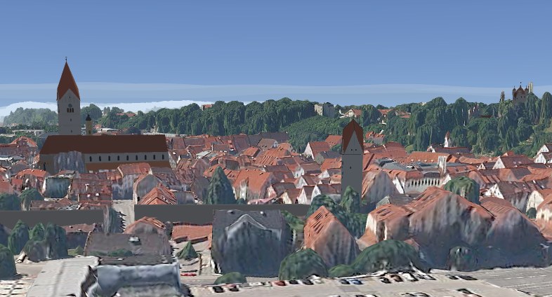
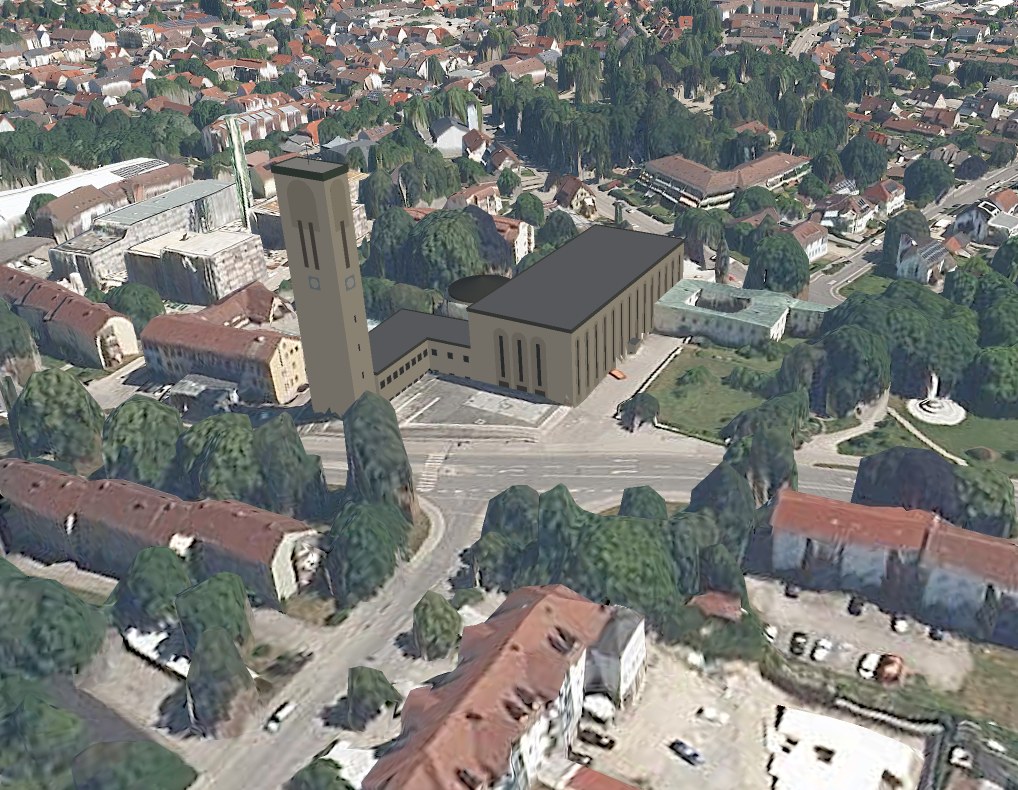
View across the old town in the city model with church, city tower and city wall as 3D models. 3D model of a church with its bell tower in the photorealistic city model.
Created and placed automatically: churches, a city tower and the city wall.
3D models

Buildings as real 3D models

crAIze SmartCity shows any building, such as churches, towers and the city wall, as a detailed 3D model with roof, windows and façade. Photos are all it takes.

The platform can create these models and place them in the right spot in the city model.

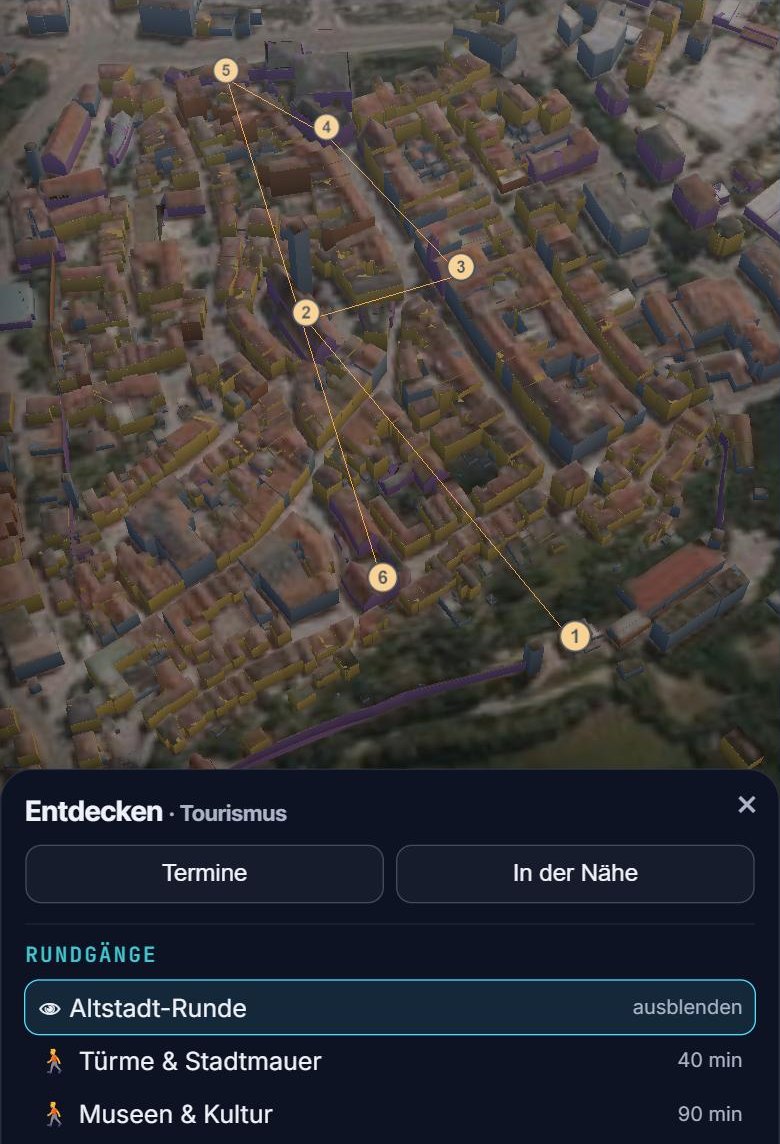
crAIze SmartCity on a phone: a walking tour with six numbered stops on the 3D city model, with the list of tours below.
A walking tour on the phone: six stops, about 75 minutes.
Walking tours

Every visitor gets their own route

Visitors say what interests them and the platform suggests the route. Based on interests and time.

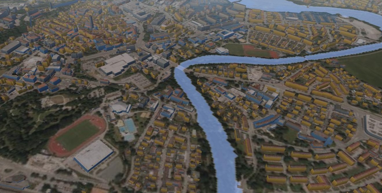
Flood simulation in crAIze SmartCity: the river at a raised water level in the 3D city model.
Flood simulation in the city model.
Simulations

What happens when the water rises?

Set the water level and see where the water stands. Close a road and see where traffic goes instead. See what can be reached from a location within a few minutes.

Six simulations run on your city's data.

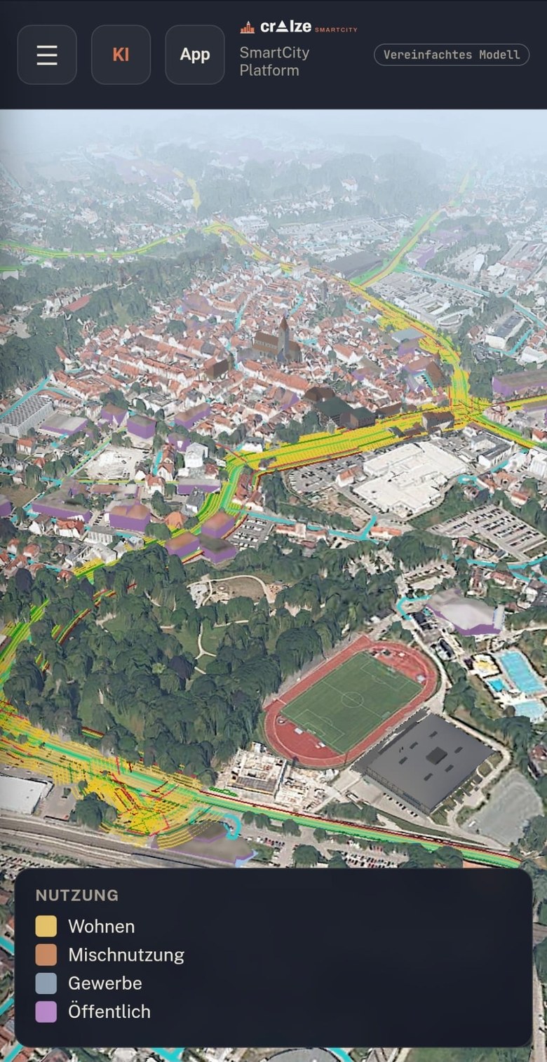
crAIze SmartCity as an app on a phone: the city model from the air with roads and building use.
The city model as an app on the phone.
App

Also as an offline app

crAIze SmartCity can be installed on the phone straight from the city model as an offline app.

Portals for companies

Utilities, network operators, developers and housing companies plan in the same city. On crAIze SmartCity they set up their own portal.

Plan

The project sits in the same city model as everything else: buildings, heat demand, solar potential and streets. Variants can be played through before anything is built.

Market

The portal shows the project to the outside world: a district heating network with every house that can connect, a new residential area with free plots and internet connections. People find their house and see what is possible for them.

Your data stays yours

Every portal has its own data and its own viewer. The company decides what goes in and who may see it.

Ready for your city in a few hours

crAIze SmartCity is fully multi-tenant and set up largely automatically. New features reach every city without updates and at no extra cost.

  • Fully multi-tenant Every city is a tenant of its own. Data and permissions stay separate.
  • Ready in hours Thanks to AI, crAIze SmartCity is set up for almost any city in a few hours.
  • Custom adjustments still possible Whatever else your city needs can be added specifically.
  • Fewer expert reports (in progress) With our AI, expert reports are set to be reduced or significantly sped up in future.

Who we are

crAIze SmartCity comes from crAIze Labs GmbH in Kaufbeuren, Bavaria. As Digital City Officer, Alex Uhrle knows the town hall from the inside; Dr. Stephan Philippi has been building AI systems for years. Both come from Enterprise Architecture.

We only show what works

crAIze SmartCity is in beta. What this page describes runs today in the demo environment. Anything still in progress is marked as such.

Every figure with its source

The data comes from official geodata and open sources. Every layer states its origin and date, so nobody has to guess what a decision is based on.

Every city on its own

Every city works in its own area, with its own data and its own permissions. The city decides who may see what.

More about crAIze Labs on craize.de

What does it cost?

Considerably less than the big vendors. We are happy to discuss what crAIze SmartCity costs for your city in a demo where we play through your questions right in the model.

Request a demo